Want to spend less time in traffic and more time enjoying Evanston’s tree-lined streets, lakefront, and neighborhood cafés? If you’re thinking about owning fewer cars or going car-free, you’re in the right place. Evanston gives you strong rail options, useful bus links, a growing bike network, and daily essentials within easy walking distance when you choose the right address. In this guide, you’ll learn where car-light living works best, how long key commutes take, what to expect for errands and schools, and how to plan around seasons and schedules. Let’s dive in.
Transit in Evanston: your options
CTA Purple Line and local buses
The CTA Purple Line is Evanston’s rapid-transit spine, with stops at Central, Noyes, Foster, Davis, Dempster, Main, and South Boulevard. During weekday rush hours, the Purple Line Express runs directly to Chicago’s Loop. At other times, you ride to Howard and transfer to the Red Line for downtown access. The city’s local bus routes knit neighborhoods to rail and Northwestern and help with short cross-town trips. You can review the city’s system overview on the Public Transportation page for Evanston and use the CTA’s Purple Line page to check current service patterns and schedules.
- Learn more about Evanston’s transit options on the city’s Public Transportation page: Public Transportation | City of Evanston
- Check schedules and express windows here: CTA Purple Line route info
Metra UP-N to the West Loop
Metra’s Union Pacific North line runs through Evanston with stations at Central, Davis, and Main in Zone 2. For many commuters to the West Loop, Metra provides the fastest, most predictable trip to Ogilvie Transportation Center, often around 20 to 30 minutes rail-only from Main or Davis depending on the train. For exact departure times and travel patterns, use Metra’s station page for Evanston Davis Street.
- See station details and timetables: Metra Evanston Davis Street
Practical reliability notes
If you work downtown, Metra is usually fastest from Main, Davis, or Central, especially during peak hours. CTA local service inside Evanston is frequent, but if you travel to the Loop outside Purple Line Express times, expect a transfer at Howard and a longer ride. Always check real-time apps and agency pages for current departure information. You can confirm Purple Line service patterns on the CTA Purple Line route info page.
Walkability and everyday errands
Where car-light living works best
If your goal is to walk most places, focus on homes within a 5 to 15 minute walk of the Davis, Main, or Central stations. These areas cluster restaurants, coffee, banking, and services within a compact footprint, and they connect to both Metra and CTA. Downtown around Davis is the largest hub. The Main–Dempster Mile is a second dense retail and dining corridor with a neighborhood feel and an easy walk to both Main Street stations. Central Street is a quieter local node with boutiques and services.
- Explore the merchant corridor here: The Main–Dempster Mile
Groceries and daily services without a car
You can cover most grocery runs on foot or by bike if you live near the rail and retail corridors. Downtown has a Whole Foods that many residents use for weekly shops. Just south along Chicago Avenue, you’ll also find a selection of specialty markets and neighborhood retailers. Many households combine these walkable options with occasional delivery for bulk items.
- Downtown grocery anchor: Whole Foods Market – Evanston
What Walk Score tells you
Central Evanston addresses commonly land in the mid to high 70s and up into the high 80s on Walk Score, which translates to “most errands can be accomplished on foot” when you stay near the rail-and-retail spine. Scores can vary from block to block, so check specific addresses near Davis and Main for the best mix of walking, transit, and biking.
- Sample a central Evanston location: Walk Score for downtown-adjacent area
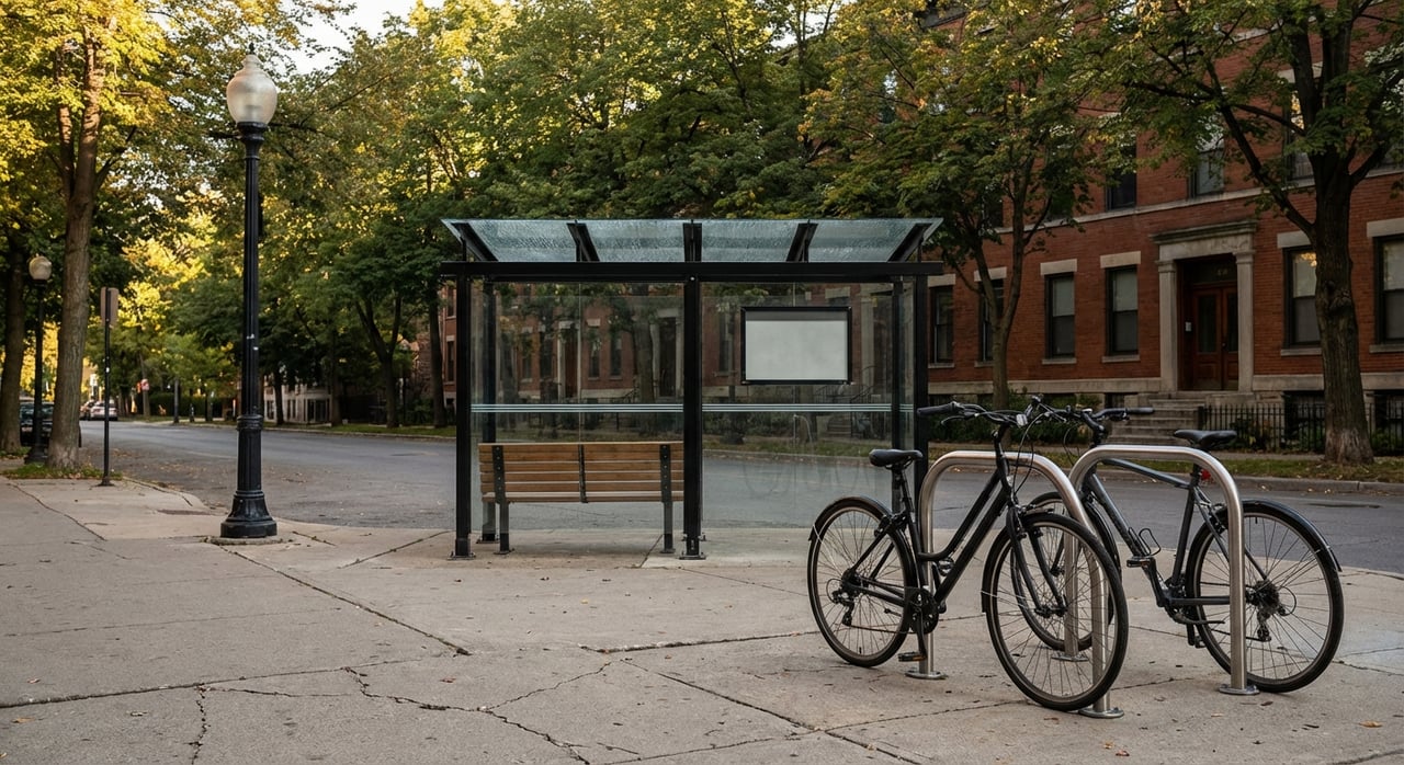
Biking and micromobility
Divvy bike-share and e-bikes
Divvy extended bike-share into Evanston with about 10 stations and roughly 100 bikes to link downtown, transit hubs, and Northwestern’s campus. The system includes e-bikes within the broader network, plus a reduced-cost membership for eligible residents through Divvy for Everyone. Bike-share is a helpful first- and last-mile option, especially for quick hops to the train.
- Details on stations and programs: Divvy in Evanston
Current and coming bike lanes
Evanston is updating its city bike plan to expand protected lanes, close network gaps, and set near-term priorities. You’ll already find buffered or protected segments on key corridors, and more improvements are planned. If biking will be a primary mode for you, keep an eye on the city’s bike plan updates and construction calendar so you know which routes will feel most comfortable.
- See the city’s bike plan update: Evanston Bike Plan Update
Seasonal planning
From spring through fall, biking and walking are highly feasible day to day. In winter, snow and ice can reduce biking days and shift behavior toward transit, ride-hail, or occasional car-share. The city’s maintenance priorities and future bike-plan policies may further support winter riding, but it is smart to have a cold-weather backup plan.
Schools and family logistics
District 65 busing basics
For elementary and middle school, Evanston/Skokie District 65 provides transportation for students who meet the district’s distance or safety criteria. The district typically notes free bus eligibility for students who live about 1.5 miles or more from their assigned school, with exceptions for certain placements. Before- and after-school care programs do not include transportation, so many car-light families coordinate walking groups, rides with neighbors, or transit.
- Confirm current policies: District 65 Transportation
ETHS and public transit
Evanston Township High School does not operate a universal yellow-bus system. Many ETHS students rely on CTA and Pace routes to get to and from school. Community leaders have highlighted the importance of stable funding and route coverage, so it is wise to review current service levels during house hunting.
- Local reporting on ETHS transit reliance: Evanston RoundTable coverage
Tips for family routines
If you want to avoid daily car trips, target homes within a comfortable walk to your preferred elementary school or inside the district’s typical bus radius. For high school, expect your student to use public transit and plan routes and backups ahead of time. Many families maintain one car for weekend activities or bulk shopping while using transit and bikes for school-day routines.
Real-life commute and errand scenarios
Downtown West Loop commuter
- Home choice: Near Davis or Main.
- Morning: Walk 5 to 12 minutes to Davis or Main. Board Metra UP-N to Ogilvie. Rail-only travel times often land in the 20 to 30 minute range, depending on the specific train.
- Why it works: Fewer transfers and a predictable schedule make Metra the fastest choice for many West Loop offices.
Loop commuter by CTA
- Home choice: Near Purple Line.
- Morning: Walk 5 to 12 minutes to a Purple Line station. Outside rush periods, ride to Howard and transfer to the Red Line. Door-to-door trips can range from about 40 minutes to over an hour, depending on wait and transfer times. During weekday rush, the Purple Line Express can reduce travel time with a direct run into the Loop.
- Why it works: Higher frequency inside Evanston and a reliable rush-hour express option when you time it right.
Errands and groceries without a car
- Home choice: Downtown Evanston or the Main–Dempster corridor.
- Routine: Walk to a nearby grocer for weekly staples or pick up a Divvy bike for a 5 to 10 minute cross-neighborhood trip. Use local shops for same-day needs. For monthly bulk shopping, combine delivery, ride-hail, or occasional car-share.
- Why it works: Dense retail near stations means short, flexible trips instead of long drives.
Pros, tradeoffs, and smart planning
What makes car-light living realistic here
- Two rail options serve central Evanston, with Metra to Ogilvie and the Purple Line to the Red Line and Loop.
- Walkable retail nodes cluster daily needs near Davis, Main–Dempster, and Central.
- Divvy stations, e-bikes, and a growing protected bike network support short trips and train connections.
- Northwestern shuttles help university-affiliated residents move within Evanston and to the Chicago campus. For transit overviews and links, start with the city’s Public Transportation page.
Constraints and how to plan around them
- Schedules vary by weekday and weekend. Build in a buffer and check real-time updates to avoid long waits.
- Some protected bike connections are still being built. Map safe options in every season, and revisit routes during construction.
- Winter weather can shift you toward transit or car-share for a few months. Have a cold-weather plan, including a nearby car-share location and a simple rideshare routine.
- If a student relies on CTA or Pace, confirm current routes and timetables each semester and have a backup if a connection is delayed.
A quick buyer checklist
- Target addresses within 0.2 to 0.6 miles of Davis, Main, or Central for the strongest walk-and-rail combo.
- Walk the area at your typical commute times and try both directions on different days.
- Compare Metra and CTA options for your exact work location and hours.
- Prioritize proximity to a grocery, pharmacy, daycare or schools, and a reliable bike-share or car-share option.
- Check Walk Score for the specific address, not just the neighborhood average. A few blocks can make a big difference.
How to choose the right address
Start with your daily routine. If your job is in the West Loop, living near Davis or Main puts you on a fast Metra line to Ogilvie. If you work closer to the central Loop, a Purple Line address with rush-hour express service may suit you, especially if you enjoy a quick walk or bike to the station. For car-light families, being inside walking distance to school or within typical bus eligibility can simplify mornings. And if errand days matter most, pick the retail corridor that fits your favorite shops and services.
When you balance all three factors — commute, school logistics, and errands — you get the flexibility that makes a one-car or no-car lifestyle feel natural rather than forced.
Local resources to keep handy
- Transit overview and agency links: Public Transportation | City of Evanston
- CTA Purple Line schedules and express info: CTA Purple Line route info
- Metra to Ogilvie from Evanston: Metra Evanston Davis Street
- Walkability snapshot for central addresses: Walk Score sample location
- City bike network updates: Evanston Bike Plan Update
- Divvy stations and memberships: Divvy in Evanston
- District 65 busing info: District 65 Transportation
- ETHS transit context: Evanston RoundTable coverage
- Main–Dempster shops and dining: The Main–Dempster Mile
- Downtown grocery anchor: Whole Foods Market – Evanston
Ready to find a home that fits a car-light lifestyle? With deep Evanston roots and a calm, detail-oriented approach, we’ll help you weigh commute options, school routes, and daily errands block by block — then tour on-market and coming-soon homes that match your plan. Let’s talk about your next move with Megan Livatino Real Estate Inc.
FAQs
How long does it take to reach downtown Chicago from central Evanston?
- From Evanston Main, Davis, or Central, Metra to Ogilvie is commonly about 20 to 30 minutes rail-only, depending on the train. The Purple Line can be faster during rush-hour express service and slower at other times due to the Howard transfer.
Which Evanston areas are best for a car-light lifestyle?
- Focus on homes within a 5 to 15 minute walk of Davis, Main, or Central stations. Downtown around Davis and the Main–Dempster corridor cluster groceries, dining, and services close to transit.
Can I handle groceries and errands without a car in Evanston?
- Yes if you live near the downtown or Main–Dempster corridors. You can walk or bike to supermarkets and local shops, then use delivery or occasional car-share for bulk items.
How do school commutes work for car-light families?
- District 65 offers bus service for eligible students based on distance and safety criteria. Many ETHS students ride CTA or Pace, so plan routes and backups and check current service each semester.
Is biking practical year-round in Evanston?
- Spring through fall is straightforward with Divvy and growing bike lanes. In winter, snow and ice can limit biking days, so line up a transit or car-share fallback and bookmark the city’s bike plan updates.